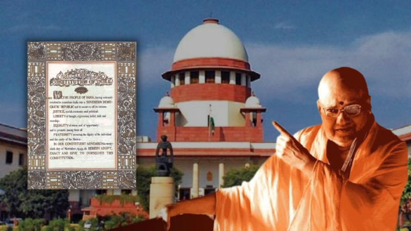
The Constitution of India is the supreme law of the land. It starts with a preamble that embodies fundamental values and the philosophy on which our constitution is based. The two values I want to emphasize here are Fraternity and Unity of the nation. The fraternity stands for the spirit of common brotherhood among the people of the country. Without fraternity, it might be arduous to implement other constitutional values such as justice, liberty, equality, and so on. A plural society like India stands divided, which will surely be a nightmare for us. The fraternity in itself carries the value of unity of the nation. We must be united as the citizens of India to protect the country from outside forces and keep its independence intact.
The first and foremost Article of the Indian Constitution also highlights the fact that India is the Union of States. While the debate on Article 1 was going on in the drafting committee, one of its members clarified the object of using the notion, 'Union of States': It was to make it explicit that India was a federation of States. The federation was an indestructible unit and not a result of an agreement between States. But what if you find the nightmare becoming true? What if you see two states of the same country killing each other?
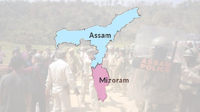
The entire issue is about the interstate dispute between the Assam and Mizoram from northeast India. The Northeastern States are often known as the 'Seven Sisters' because they are interdependent on one another. Simultaneously, it focuses on the special bond these states have with each other. To understand the ongoing boundary dispute between Assam and Mizoram we need to go back to the 19th century. There is a 165 km long boundary between Assam and Mizoram known as Lusia Hills which was a district of Assam. The two notifications i.e. 1875 and 1933's notification issued by British authorities at the heart of this dispute. The reasons behind the issuance of these notifications could be well-understood, only after revisiting the historical events
Here, history has a lot to say. Northeast India originated in the 19th century during British rule in India. In 1826, the British took control of some parts of Assam by entering into the treaty of Yandaboo with the Burmese. Later, in 1830 after the assassination of Kachari king, Raja Gobind Chandra, who had no legal heirs, his territory (Cachar plains) was lapsed to the British according to the 1826 treaty. British in 1855 introduced tea cultivation on a commercial scale in Cachar and Lusai hills. Mizo tribe found it to be an encroachment in their shifting cultivation and hunting. So the Mizo tribe of Assam started raiding and kidnapping in the Cachar valley. The frequent raids upon the plain were a matter of concern to the British administration. So, they decided to utilize a strong expeditionary force to Lusai hills to stop these raids. The expedition of 1871 induced British authority to demarcate, leaving it vague and imaginary. The Notification of 1875 framed under the Bengal Eastern Regulation Act of 1873 sought to demarcate Lusai Hills from the plains of Chachar. This was the basis for the Inner Line Reserve Forest demarcation.
Now we will fast forward to the map of 1933 drawn by the British Survey of India along linguistic and tribal lines leading to a new boundary separating Lusai hills, Cachar plains, and the former princely state of Manipur.
Till now Mizoram (Lusai hills) was a part and parcel of Assam. In 1959 Lusai hills were devastated by a severe famine known as the 'mautam famine' of which Mizo had warned Assam and the Union Government and demanded relief. However, the Assam government rejected the resolution as such anticipation was not scientific, and famines are unpredictable. Hence, leading it into a revolt by Mizoram National Front (MNF), a welfare organisation formed during the famine. The MNF conducted an insurgency for almost 20 years after declaring independence as its goal. Ultimately through a peace accord called as Mizoram Peace Accord or Memorandum of Settlement with the Union Government, Mizoram got statehood in 1987. Before this, it had already received the status of Union Territory under the North East Area Reorganisation Act 1971. The Hills were declared as 'excluded area'. Now the situation is that both the state of Assam and Mizoram are demarcated from each other.
Currently, the dispute based on 1875 and 1933's demarcation is that- Mizoram believes in 1875 demarcation where the Mizo chief was properly consulted while Assam Government follows 1933 demarcation. The Mizoram-based Joint Action Committee stated that the Inner Line Reserve Forest, which is currently administered by the forest department of the Assam Government to be handed over to the forest department of Mizoram. A Memorandum was sent to Prime Minister in 2018 that says, areas such as Cachar Zion, Lala Bazar, and Bhanga Bazar having large number of Mizo population were excluded from Mizoram in the demarcation of 1933. This is also one of the reasons for not agreeing on 1933's demarcation. The first major incidence of border dispute arose in 1994 followed by disputes and violence in 2006 and 2018.
Currently, Assam and Mizoram are witnessing violent incidents since 2020. The situation took the worst turn on 26 July 2021, when few policemen were killed in a violent clash and the series of allegations and counter-allegations encroachment of Assam and Mizoram began. Assam contended that Mizoram started constructing roads by destroying the Inner line reserve forest and set up a police camp in Lailapur of Chachar district of Assam. Assam officials visited the place to request Mizoram authorities to maintain the status quo but it led to violence. On the other hand, Mizoram refused Assam's claim. It contended that Assam authorities forcibly crossed the duty post manned by CRPF personnel stationed there and overran a duty post manned by one section of Mizoram police personnel. They damaged several vehicles travelling along with the National Highway. The civilians were assaulted, lathi was charged, and tear gas was used.
Going a step ahead Assam Government issued a travel advisory asking locals to refrain from travelling to Mizoram amid an ongoing interstate border dispute. It also added that people of Assam staying at Mizoram due to work should exercise utmost caution. The Assam government also issued a notice to check vehicles travelling from Mizoram to Assam to curb the illegal drug trade. To this Mizoram Government contended that during the last 10 years, huge quantities of illicit drugs were seized in Mizoram, smuggled from the Assam side. The Assam government also imposed an economic blockade with Mizoram. It was not the first time to impose such an economic blockade. Meanwhile, the Twitter war, the blame games, lodging FIRs against each other's higher authorities, and so on continued. Afterward, the Assam government took back both travel advisory and notices issued. It also removed the economic blockade. But the situation has not cooled down yet.
As mentioned before, it was not the first incidence of violence in the recent past. In 2018 MZP (Mizo Zirlai Pawi), a students union had built a wooden rest house in the forest for farmers. But the Assam Police and forest department demolished it claiming it was in Assam's territory. Then in October 2020 dispute between Assam and Mizoram again erupted in which eight people were injured, and the property was destructed. Again in the same year violence on the border of karimganj from Assam and Mamit from Mizoram erupted, wherein farm huts, crops were set on fire. After this, In 2019 both the states agreed to maintain the "status quo" in "no man's land". However, people from Lailapur broke the status quo and allegedly constructed some temporary huts. People from Mizoram went and set fire on them. According to the state of Assam, the contested land belongs to Assam, while Mizo people say that they are cultivating on that land for a long time.
It is sad to mention that the dispute between Assam and Mizoram is not the only interstate boundary dispute. Assam has a boundary dispute with its neighbouring states/ Union Territories such as Arunachal Pradesh, Nagaland, and Meghalaya. The main reason behind this is that these states/ Union Territories used to be part of Assam in the past. The dispute between Assam and Arunachal Pradesh is before the Supreme Court of India, yet no way has been derived. In the case of the Assam-Meghalaya dispute, there was a first-ever meeting between the Chief Ministers of both States in the recent past. Other than this there is a boundary dispute between other states like Maharashtra and Karnataka, Ladakh and Himachal Pradesh, etc.
The main reasons for a dispute between the northeastern states are:
• Each state is trying to occupy the resource-rich land to expand its trade and economy.
• They have their own ethnic identity. And to preserve its own identity there is an attempt to suppress the ethnic identity of one state by the other and vice-versa.
• The boundary demarcations in existence lack effectiveness, they are improper, and mainly local tribes were not consulted during this process.
• The ongoing insurgencies also play a significant role. The presence of insurgent groups in this region further complicated the situation. They restrict the free movement of people creating safety defending the territorial integrity less focus on boundary conflict.
• If to speak specifically of Assam and Mizoram settlement of illegal Bangladeshi immigrants in the forest of Lailapur is also one the reason for conflict between two states.
Now the question is how these disputes can be resolved. First of all, there is a need for a proper ‘Centre led’ initiative to solve the border issues and demarcation of borders. There can also be a good help from technology. The use of satellite mapping to demarcate boundaries and settle such disputes is also a good way out.
The presence of collaborative leadership in most states can lead to agreement on border issues, and the presence of the central leadership would lead to faster implementation of the solution in the region. The involvement of the Supreme Court can also play a vital role in the resolution of the matter. But there is also a need to observe legal delays. The Supreme Court of India in 2005 directed Central Government to constitute a boundary commission to resolve the various interstate boundary issues in the Northeast. Following this, the Centre had constituted Sundaram Commission (1971) and Shastri Commission (1985) to settle the Assam Nagaland border dispute, but both failed. Then there is Article 263 of the Indian Constitution under which the Interstate council is expected to inquire and advise on disputes, discuss subjects common to all states and make recommendations for better policy coordination. The dispute can also be looked into with the help of zonal councils. In this connection, it may also be proper to mention that a North Eastern Council has been set up under the North Eastern Council Act, 1971.
Maintaining a peaceful North East is vital for India’s ‘Act East Policy' as the North East Region is also a doorway to the ASEAN regions. All the states connected need to have peaceful borders to ensure ‘free’ movement of people and trade. Moreover, the presence of China via its BRI near India’s North-East makes it all the more important to solve the North East internal border conflicts’ as soon as possible. Other than this such disputes are a major threat to the values of fraternity and unity in India which we surely need to observe. There is always a ray of hope, and we can look forward to having a firm solution to resolve these disputes.
- Adv. Prachi Patil
pprachipatil19@gmail.com
(The writer is a practicing lawyer at the Pune District Court and the Family Court, Shivajinagar)
Tags: Adv. Prachi Patil Conflict Assam Mizoram North East Load More Tags

















Add Comment